| 1. |
A ____________ provides continuous coverage, it tends to contain more information than is needed for any specific or immediate purpose. |
|
|
Digital raster map |
|
|
Conventional vector map |
| 2. |
The most significant benefit of using a PPK-enabled UAV/SfM solution is that the image acquisition and processing workflow does not include the provision of GCPs and is thus virtually fully automatable; hence requiring only a fraction of skilled human input time that would have been required in a conventional survey. |
|
|
True |
|
|
False |
| 3. |
To map a small holding of 9 ha, the UAV mapping method could deliver in less than ___________ of the turn-around time that a conventional approach would have required. |
|
|
20% |
|
|
30% |
|
|
40% |
|
|
50% |
| 4. |
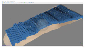
The following figure represents ________________.?
 |
|
|
ATV and RTK GNSS to place and survey 32 GCPs |
|
|
Alignment of the 6,023 aerial images and the distribution of the 32 GCPs |
|
|
Adopted digital surface model (DSM) |
| 5. |
To optimise efficiency, a topographic survey is typically divided into _________________ separate operations. |
|
|
2 |
|
|
3 |
|
|
4 |
|
|
5 |
| 6. |
Field operations require significantly more capital and resources than office work. |
|
|
True |
|
|
False |
| 7. |
The optimum accuracy in a raster map is determined intrinsically by the _______________.? |
|
|
Size of individual pixels |
|
|
Rotation angle |
|
|
Quality of spatial attributes |
|
|
All the above |
| 8. |
The Double DV Ranchette, located in central Missouri, USA, comprises an agricultural smallholding of some 11.6 ha. Originally consisting of cropland (alternating maize and beans), the land has been converted to a sheep farm. An additional undeveloped tract of some 8.9 ha was acquired in March 2016 to increase grazing capacity for a herd of some 100 sheep. A survey of the new, undeveloped tract was needed to __________________.? |
|
|
design grazing paddocks |
|
|
provide enough control points for setting out of new fence corners. |
|
|
verify the correct alignment of perimeter fencing relative to cadastral boundaries |
|
|
All the above |
| 9. |
The most significant benefit of using a PPK-enabled UAV/SfM solution is that the image acquisition and processing workflow does not include the provision of GCPs and is thus virtually fully automatable; hence requiring only a fraction of skilled human input time that would have been required in a conventional survey. |
|
|
True |
|
|
False |
| 10. |
The equipment needed to perform ‘A-to-Z’ SfM mapping can be purchased for some______________ . |
|
|
US $5,000 |
|
|
US $10,000 |
|
|
US $20,000 |
|
|
US $30,000 |
|